Supporting Tribal-Led Salmon Monitoring Using Computer Vision

Project Update:
November 2023
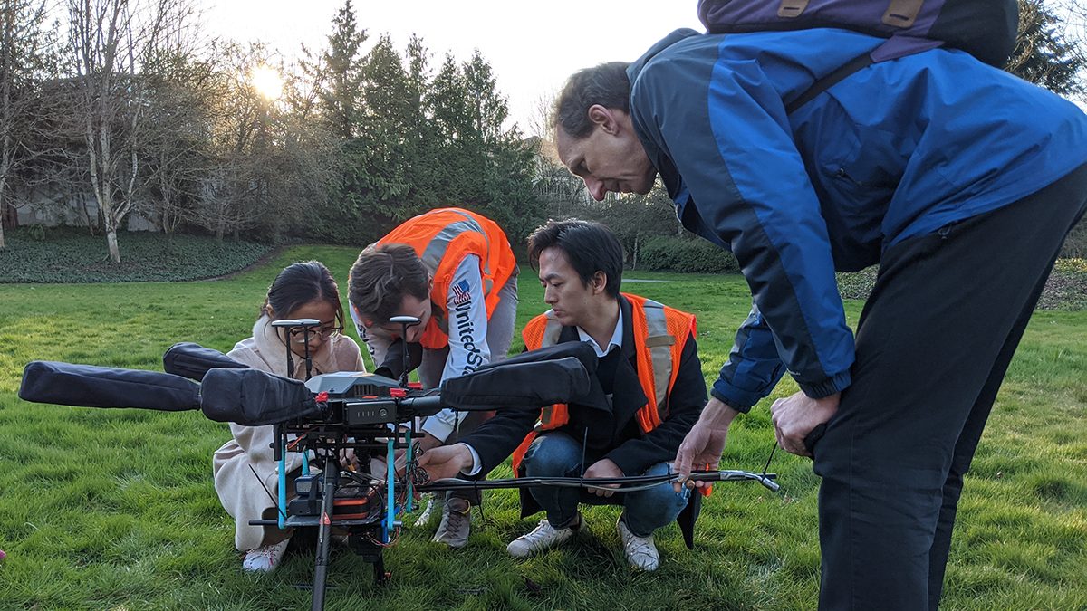
Efforts this past summer and fall have focused on laying the groundwork for future automated detection of redds, as well as developing data collection methods to be used for the final system. The team has conducted several drone-based surveys on the Skagit River to better understand the terrain and collect imagery to develop and train computer vision models to detect redds. The team has also been conducting small-scale drone surveys on a short stretch of the Snoqualmie River (closer to campus) to assess the quality of orthomosaics generated from various flight patterns and data collection methods. Currently, the team is developing and refining a computer vision pipeline for automated redds detection.
- News article published 11/22/23: Supporting Tribal-led salmon monitoring using computer vision | Aeronautics and Astronautics (washington.edu)

Overview:
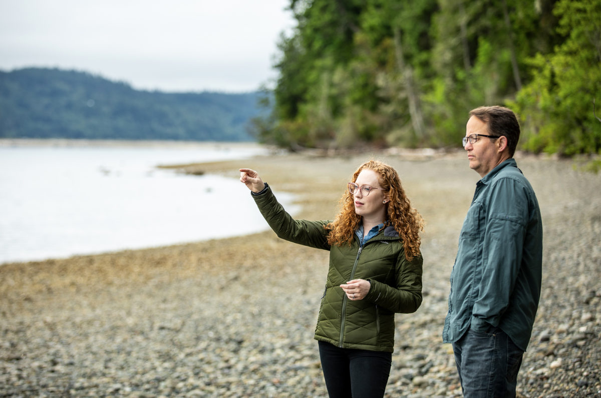
Pacific salmon are a vital part of Indigenous cultures and a keystone ecological species throughout the Pacific Northwest. In Washington, Tsuladxw [salmon] are the most important cultural and sacred food of the Sahkuméhu [Sauk-Suiattle people], who consider them their relatives under the water. The Skagit River, in the ancestral lands of the Sahkuméhu, provides habitat for all five species of Pacific salmon, including two ESA listed species and is a critical food source for Southern Resident orcas.
The Sauk-Suiattle Indian Tribe co-manages the Skagit River salmon with the state. Currently Sauk-Suiattle fisheries managers depend on state-led helicopter surveys of salmon spawning grounds to estimate population sizes and set harvest guidelines. Climate change has a two-fold effect on the efforts to estimate the Skagit River salmon population. First, changing climate is decreasing salmon survival in rivers and at sea, increasing the need for responsive and data-based management. Second, warming conditions are changing snowmelt patterns that alter river flow regimes in ways that make helicopter surveys less feasible. In recent years, helicopter surveys have not been possible due to water conditions on survey days. To address these issues, the Sauk-Suiattle Indian Tribe has initiated a program to begin their own drone-based aerial salmon survey.
Goals:
- Build a safe, cost-effective, and accurate system based on drones and AI-based computer vision to monitor numbers of spawning Chinook salmon in the Skagit River and its tributaries.
- Have drone-based surveys led by the Tribe, rather than the state, meeting the Sauk-Suiattle Indian Tribe’s goal of implementing innovative methods and technology for natural resource application.
- Create open-source tools for other Tribes, state managers, and conservation groups to easily and accessibly use for similar future projects.
Approach:
This research team partnered with the Sauk-Suiattle Indian Tribe to develop a system combining automated drone flights and AI-based analysis. This method enables opportunistic data collection under varying conditions and integrates Tribal expertise into the design and implementation of monitoring protocols. The process also included a human-in-the-loop system, where AI models assist biologists in identifying salmon nests from drone imagery. The team also used photography in surveying and mapping to measure distances between objects by stitching river images into high resolution maps. This will allow Tribal biologists and researchers to keep track of the positions of redds across and between seasons for a more dynamic monitoring process.
Research Focus:
- Evaluate salmon spawning populations in the Skagit River, particularly Chinook.
- Develop drone-based imaging protocols for accurate data collection.
- Train AI models to identify and count salmon nests efficiently under diverse conditions.
- Explore how salmon adapt their habitat use in response to climate change.
Why It Matters:
Accurate monitoring of salmon populations is essential for effective co-management of fisheries and recovery planning.This team’s methods give the Sauk-Suiattle Indian Tribe independence to collect their own data to best co-manage their salmon fishery while also allowing Tribal and UW biologists to explore how the salmon use fine-scale habitat decisions to adapt to climate change. The open-source tools and methods developed can be both replicated and used by other Tribes, state managers and conservation groups and we have specific plans to share our methods with these groups throughout the Pacific Northwest.
Activities:
- Plan drone flight paths for survey reaches in the Skagit River.
- Conduct test flights and gather high-resolution images of spawning grounds.
- Train AI models using Tribal-verified data to identify salmon nests in drone imagery.
- Apply photogrammetry to map salmon nests and monitor habitat use over time.
- Share protocols and software with Tribal and conservation partners.
Expected Outcomes:
- A safe and effective drone flight protocol for salmon monitoring.
- Open-source AI software for automated detection and counting of salmon nests.
- Increased capacity for the Sauk-Suiattle Indian Tribe to manage salmon populations independently.
- Improved understanding of salmon habitat use and adaptation to changing conditions.
Dissemination of Findings:
Findings and tools will be shared with the Sauk-Suiattle Tribal Council, other Tribes, and state managers through reports, white papers, and presentations. The project team will present results at the Native American Fish and Wildlife Society’s annual conference and publish findings in peer-reviewed journals. These efforts aim to scale the solution regionally and foster collaboration among stakeholders.
Research Team:
Principal Investigator: Andrew Berdahl, UW Seattle, College of the Environment, Aquatic & Fishery Science
Community Lead: Grant Kirby, Fish Program Manager, Sauk-Suiattle Indian Tribe
Student: Benjamin Koger, UW Seattle, College of the Environment, Aquatic & Fishery Science
Collaborators: Karen Leung, UW Seattle, Aeronautics & Astronautics